


How Does Our Radar “See” Beneath the Surface?
| Radaz | Blog
Have you ever wondered how our technology can detect, in detail, what lies hidden beneath the ground — even in areas with dense vegetation, low visibility, or limited access?
Here’s the full explanation.
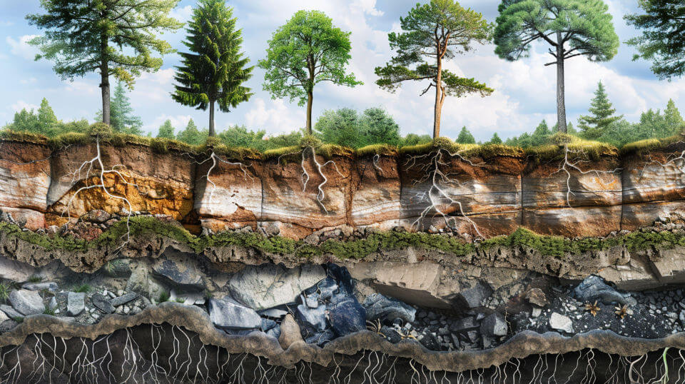
Radaz’s Synthetic Aperture Radar (SAR), mounted on drones, operates using three frequency bands: C, L, and P. Each band plays a specific role, and together, they enable a comprehensive reading of the different layers of soil and vegetation.
Understanding the Role of Each Band
C Band
Captures information from the surface layer of vegetation and soil. It’s ideal for shallow, fast analyses in exposed areas.
L Band
Penetrates slightly deeper, allowing for the mapping of vegetation volume and shallow subsurface structures.
P Band
The deepest of the three bands. It penetrates vegetation and soil, reaching depths of up to 120 meters — making it perfect for complex geological and structural investigations.
What Can This Technology Do?
By combining these bands, Radaz’s radar delivers detailed and strategic analysis for a wide range of sectors. Here are some of its main applications:
- Early detection of dam failures — anticipating risks and helping prevent disasters
- Detection of leaks in pipelines — even in remote, densely vegetated areas
- Mapping landslide-prone zones — essential for civil works and urban planning
- Measuring ground subsidence — caused by natural phenomena or human activity
- Locating buried structures — including pipelines, mineral deposits, or even archaeological remains, even under forest cover
- Agroforestry intelligence — such as accurate forest inventory, soil moisture levels, water table identification, and even pest detection, with exact location and size on the property
High-Tech, Lightweight, and Practical
Our radar weighs just 5kg and is mounted on compact drones. After the flight, the data is automatically processed by a laptop, generating everything from images to detailed georeferenced reports — ready to use.
All of this is made possible with 100% Brazilian technology, already being used in projects around the world.
Want to learn how Radaz can help transform your operation?
Get in touch with our team today and harness the same technology global leaders rely on to succeed.