How does SAR technology work?
| Radaz | Blog
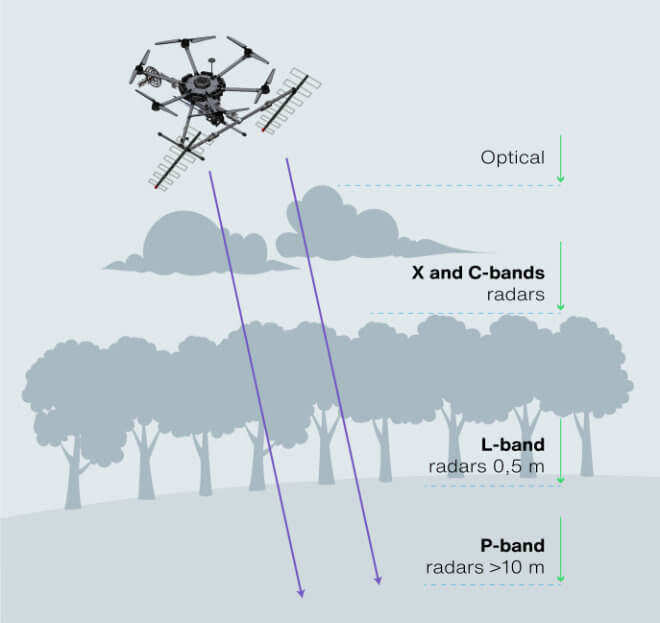
SAR, or Synthetic Aperture Radar, is a powerful technology that uses electromagnetic waves to obtain high-resolution two- and three-dimensional images of the Earth's surface and subsurface. Unlike optical sensors, SAR can see through clouds, fog, darkness, vegetation and underground, making it a valuable tool for a wide range of applications in the environment, agriculture, civil protection, mining and smart cities.

By sending pulses of electromagnetic energy and measuring their reflections, SAR can study land cover, surface and subsurface and provide information about land cover, digital surface model, orthorectified surface image, digital terrain model and subsurface tomography. It can provide unique information such as gravimetric soil moisture and soil subsidence under dense vegetation, the location and size of anthills under industrial forests, and the tuber biomass map to accurately predict harvest date.
Thanks to advances in SAR technology, we now have access to more data than ever before, which is helping us better understand our planet and make more informed decisions about how to protect it. From tracking surface subsidence to prevent natural disasters to mapping the growth and health of forests and crops, SAR is proving to be an invaluable tool for scientists, policymakers and citizens.

